Holsbeek · Heritage
Kasteel van Horst
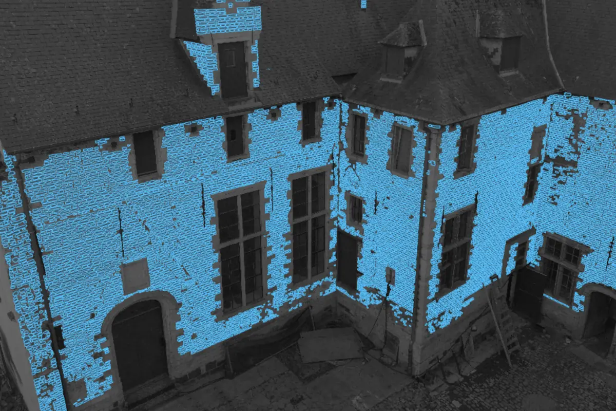
A moated castle, captured with a consumer drone: a point cloud and a mesh of the whole building. Shown: every brick of the courtyard, found on a drone photo.
- 633drone photos
- 13windows found on one photo
Coming soon
A spin-off of Ghent University and imec.
Stop remeasuring façades. Fly once. Get every opening, every surface and every dimension of the building, as a model, as drawings and as a quantities table.
Success You are on the list.
One click helps us: what describes you best?
Thanks, noted. Have a building in mind? Tell us about it.
Plan and mesh: Kasteel van Horst, Holsbeek. Measured: building T4, Campus Ufo, Ghent.Data © Digitaal Vlaanderen
Today
Today
With VoxelBond
Belgium has 4.57 million buildings, each with façades to document (Statbel).
How it works
You bring the building. We return the answers.
Step 1 · Plan and capture
Draw one polygon on the map and press Plan flight. VoxelFly works out where every photo has to be taken, routes the flight clear of trees and neighbours, and writes the mission file for a small DJI drone. It runs in the browser, on the open height data of Flanders.
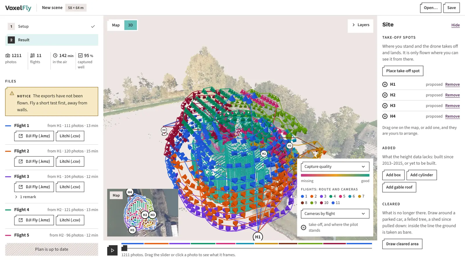
Kasteel van Horst, planned in 3D
1,211 photos in 11 flights from 4 take-off spots, 142 min in the air. The planner expects 95 % of the castle to be captured well.Data © Digitaal Vlaanderen
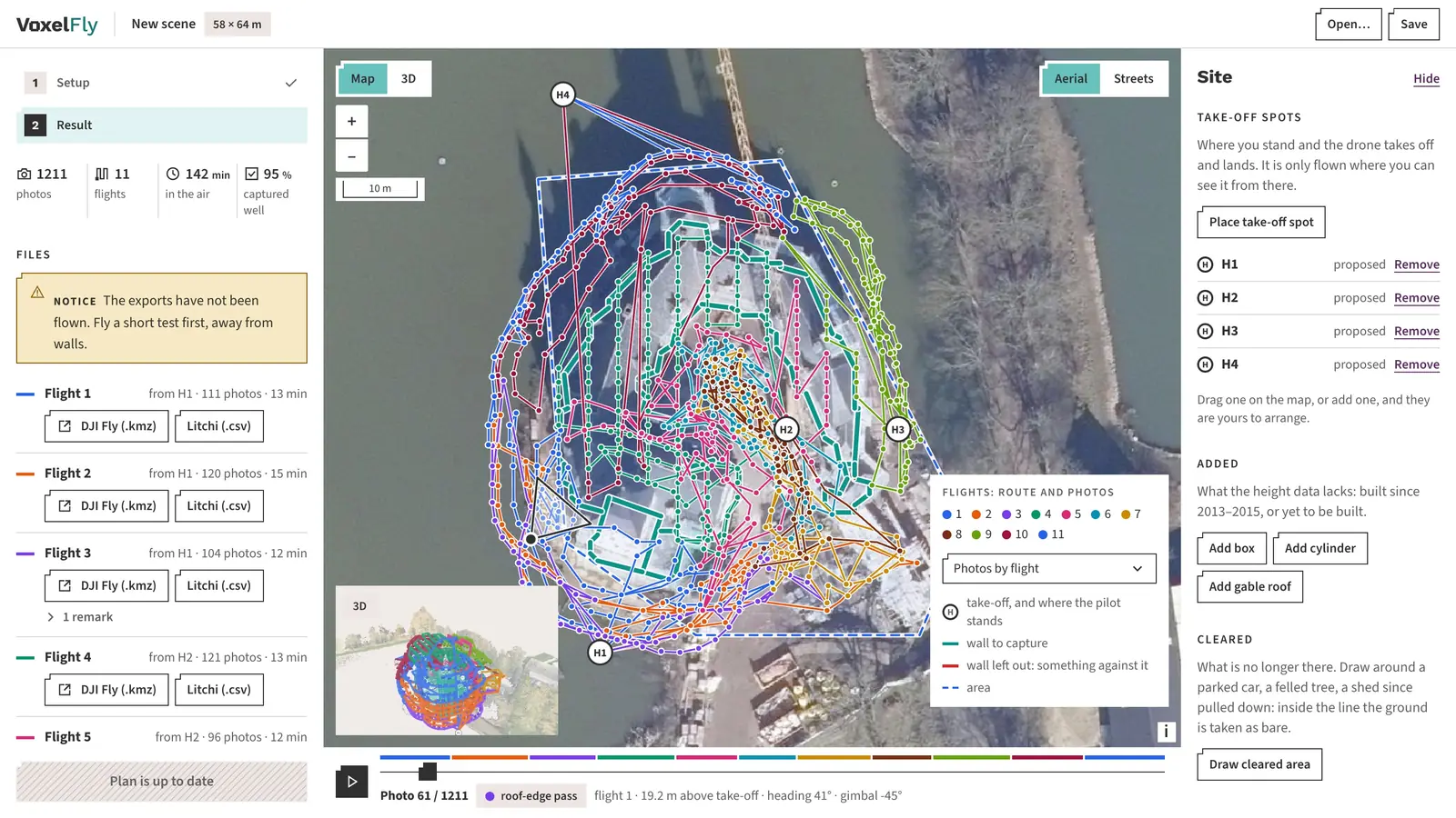
The same plan on the map
Each flight in its own colour, with the take-off spots where the pilot stands.Data © Digitaal Vlaanderen
All of Flanders in a browser
Our viewer streams the open height data of Flanders, about 4 TB of points, on any laptop or phone.Data © Digitaal Vlaanderen
Step 2 · Reconstruct
Upload the photos. We build a dense point cloud of the whole building, or of a whole campus, and from it a 3D mesh and orthophotos. Explore it in a browser, or take it into your CAD or BIM software in open formats.
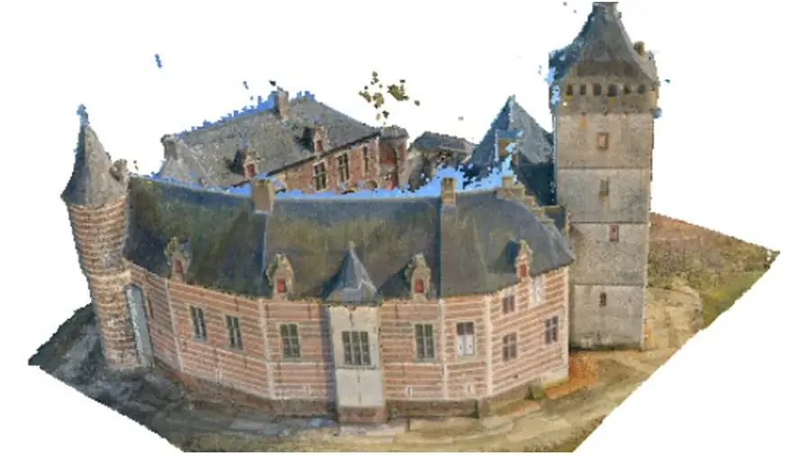
Kasteel van Horst, Holsbeek
The point cloud of the whole castle, built from its drone survey.
Explore the point cloud in your browser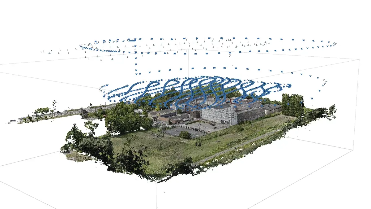
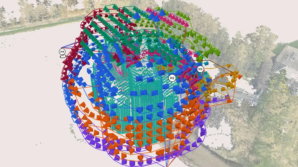
College Melle: where the drone took its photos
Each blue mark is one photo position, in rings above the whole campus.
Explore the campus in 3DStep 3 · Analyse and share
Windows, panes and bricks are found on the photos, placed on the 3D model and measured. You get a model, drawings and a quantities table, in open formats.
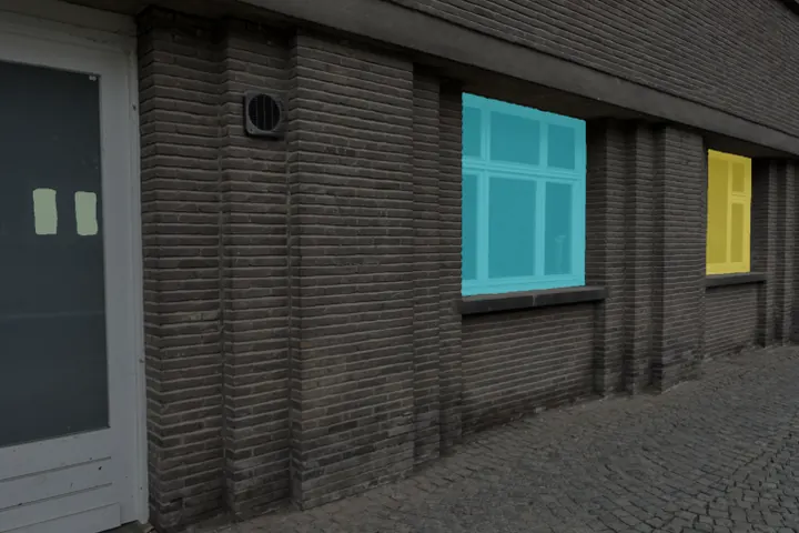
Found on the photos
Building T4, Campus Ufo, Ghent: the windows found on one of its 19 phone photos.
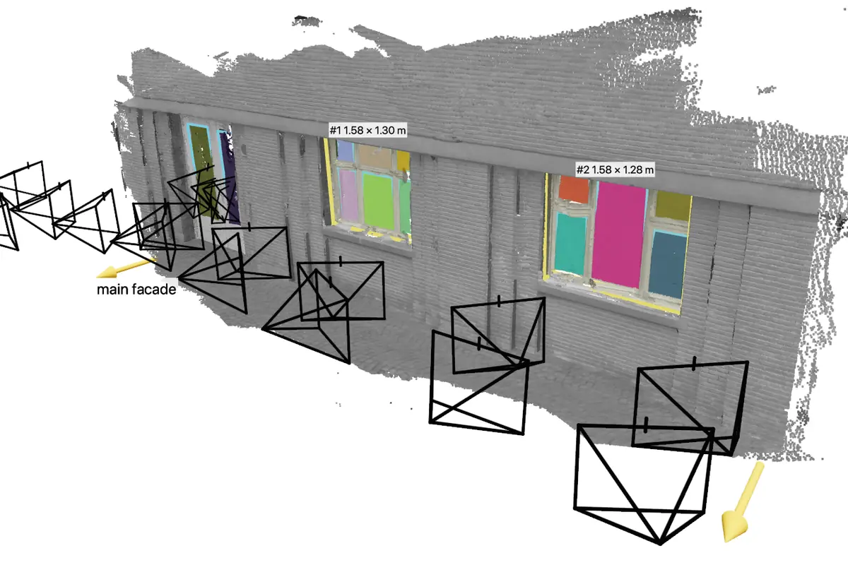
Placed on the 3D model
The point cloud of building T4, where each photo was taken, and both windows with their panes.
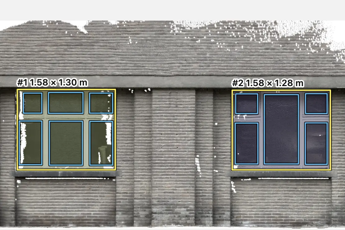
Measured
Window 1 is 1.58 × 1.30 m, window 2 is 1.58 × 1.28 m, read off the model.
Results
A heritage castle, a school campus and two buildings of Ghent University, from the photos to measured windows and every brick.
Holsbeek · Heritage
A moated castle, captured with a consumer drone: a point cloud and a mesh of the whole building. Shown: every brick of the courtyard, found on a drone photo.
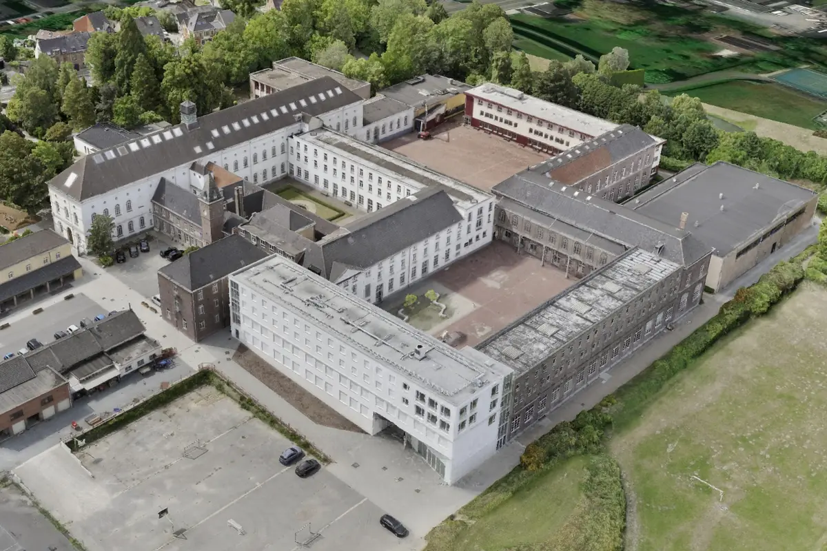
Melle · School campus
A whole school campus in one 3D model, built from drone photos: every wing, courtyard and roof.
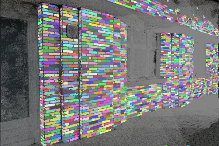
Ghent · Campus Ufo
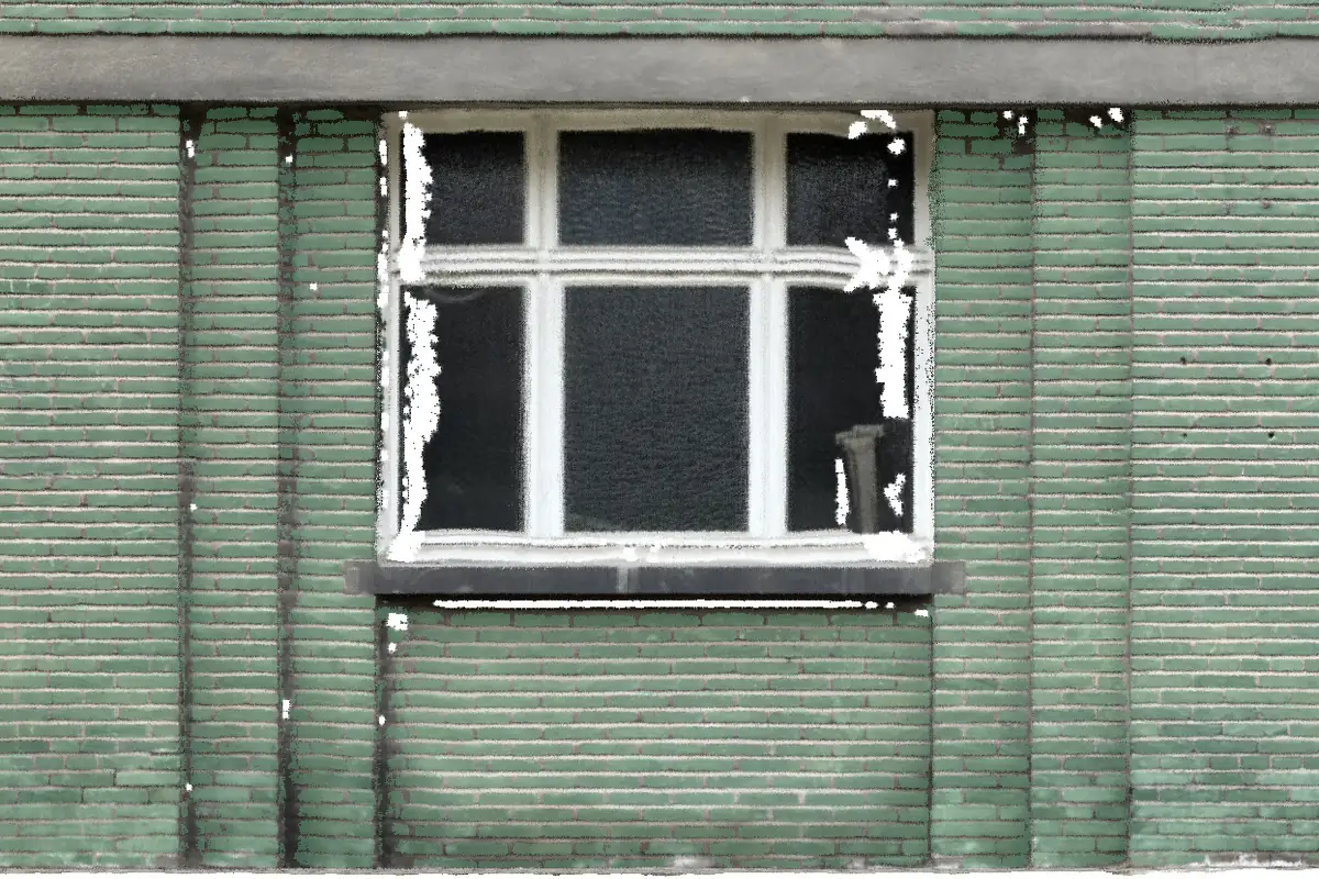
A brick wall with a door and two windows. Shown: the bricks found on the 3D model, one by one.
 0.80 × 1.00 m
Ghent · Campus Ufo
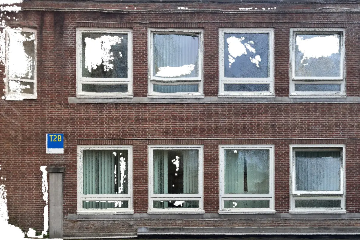
An office façade on two floors. Shown: nine of its windows, one marked with its size.
About
VoxelBond grew out of two research groups at Ghent University and imec, Building Physics and Image Processing and Interpretation (IPI), and is affiliated with the UAV Research Centre (URC).
Founder: Philippe Soubrier, building physics and image processing, Ghent University.
One platform stands in for flight planning, photogrammetry, the point cloud and the heavy computer.
Objective and repeatable: every opening counted, located and sized.
Built partly on the open data of Flanders; the results leave in open formats. We are not a host.
Questions
VoxelBond turns ordinary drone photos of a building into a measured 3D model. Windows, panes and bricks are found and measured, and you get a model, drawings and a quantities table in open formats.
A small consumer drone is enough. VoxelFly plans the flight and writes the mission file for DJI consumer drones such as the DJI Mini 4 Pro, which weighs under 250 g.
A point cloud and a 3D mesh of the building, orthophotos, and every opening with its width and height, in open formats for your CAD or BIM software.
No. VoxelFly runs in the browser, and the 3D results open in a browser from a link.
Yes, with a pilot project: we document one of your buildings end to end. Service projects follow in the first quarter of 2027, and a self-service platform in the second quarter of 2027.
In Flanders first: VoxelFly plans flights on the open height data of Flanders. VoxelBond is based in Ghent, Belgium.
VoxelBond is a spin-off of Ghent University and imec, founded by Philippe Soubrier. It grew out of the research groups Building Physics and Image Processing and Interpretation (IPI), and is affiliated with the UAV Research Centre.
Pilot projects
Tell us about a building and the question you need answered. We propose a pilot and show you the result on your own building.
Or ask us anything. Your message comes straight to us, and we reply by email.
| When | What |
|---|---|
| Now | Pilot projects on real buildings, with our first partners |
| Q1 2027 | Service projects: we fly and deliver the full analysis |
| Q2 2027 | Self-service platform: fly your own drone and upload the photos |
Success
Your message is on its way. We reply by email.